
|
I think you will all agree, we have just had the most amazing period of text book high pressure weather lasting for what must have been a month and a half at least, maybe longer, to be honest I stopped keeping track as it became a normal part of every day life which I took for granted, it was dream weather. UK/Ireland turned out to be the driest place in all of Europe and the latest figures have now confirmed that this was the sunniest period ever recorded in N. Ireland since records began.
Every single day was sunny and warm complimented by blue skies and perfect endless clear nights, I got to check the TCrB field in Corona Borealis multiple times nightly, every night, and I will be honest with you, I was starting to get sick looking at it, that's how clear it was! Many BBQs were enjoyed and everyone was in top form. However this kind of high pressure wasn't good for convection, we had a few set-ups showing up but they mostly resulted in busts thanks to capping inversions, dry air aloft, insufficient moisture depth, or just not enough lift going on, so the period remained dry with borderline drought conditions. I had soaked up as much sunlight as possible but was badly in need of a nature fix, in short it was time to get thunderstorms and I was ready to sacrifice any future HP to get them.
Late May began to show a pattern shift with low pressure influences and an increasing moist low level feed from the S and the models began to show instability, in particular May 20th was showing, finally something to chase, it was time to look at the details. The Republic of Ireland had already been doing well with several days of organized thunderstorms, there was even a spectacular shelf cloud approaching Dublin from an elevated storm which may have earned the title of the most spectacular shelf cloud ever captured from Ireland, I can only think of one other day which would have come close so that was an impressive catch. On May 20th it was the north's turn, actually it was the most widespread CAPE day of the season with much of the country covered in energy. CAPE ranged from 500 to 900j/kg with LIs between -2 and -4 with -35c cool pool aloft on a very light Sly flow which would back to an Ely mid afternoon then to a Nly by evening. Several good convergence zones were in play and DLS was strong in the south, N. Ireland was less sheared with 20 knots of 0-3km shear at best which would still be enough for brief organization so I was anticipating slow moving pulse storms, with little in the way of structure, with transient multicell modes not being ruled out, I was happy to take anything at this stage.
Models showed several good areas worth chasing such as the border, all of Co. Fermanagh, parts of the Sperrins, but I was interested in the more isolated cells the AROME was showing later in the day from late afternoon into late evening. These looked to form over the Maghera area then move S over and W of Lough Neagh, over Co. Tyrone, because they were so isolated on the models they looked like better targets for me. The day began warm and felt like a storm day, for the first time this year I could feel the humidity in the air, beefy white cumulus clouds interrupted the blue skies and became agitated, by late morning a few small towers formed but I noticed something I didn't like. The clouds had that capped look about them and the tops appeared dry and ragged, I began to get a sour feeling. Meanwhile storms had erupted down south yet again and despite models showing showers for the north since 10am the country was completely dry, once again proving the cap was at work. It's worth mentioning here that a cap of the correct strength can be a very good thing indeed, it stops the rapid formation of early showers and storms which can introduce cloud and cool air which might affect potential later.
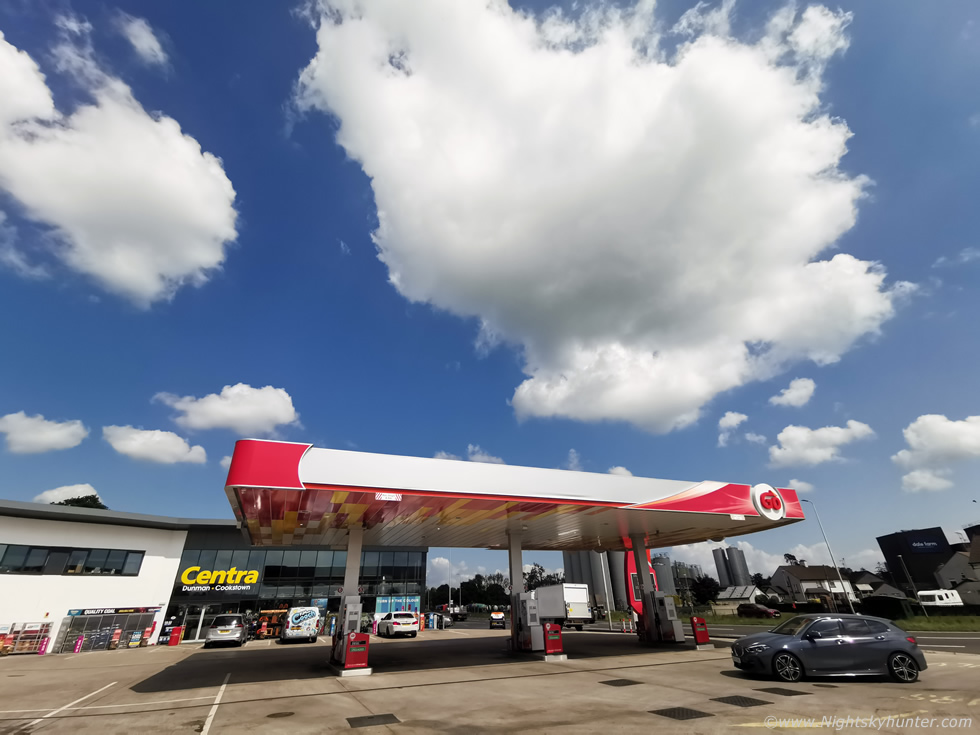 |
The ideal cap set-up is the loaded gun scenario when the warm lid stays over the mid levels while energy builds below. If the cap erodes later in the day then this energy can form explosive thunderstorm development like we witnessed in 2023. I had a feeling this was not going to be one of those days but I did hope the cap would break later. By mid afternoon I went out for a drive to check the sky. I grabbed an ice lolly and examined the cumulus field from the GO Station near Cookstown, there should have been showers and storms now but the cumulus clouds didn't look good at all, but at least they looked pretty. I observed several towers to the S develop then lean over under the inversion and die, at this stage I had kind of given up on the day then went back to the house to check radar and the latest updates.
By 16.00 something had changed, sat images and visual reports had showed agitated updraughts bubbling over Ballymoney then drifting towards Coleraine, they began to produce precip, could the cap be breaking? of course the radar picked a bad day to play up so things were difficult to make out. Then a new tower formed over Glenshane Pass and suddenly was producing a red core, my gut was telling me that outflow from the Ballymoney/Coleraine showers was starting to trigger new activity which was beginning to move W thanks to the current Ely flow. I then got a message from Owain Rice saying he detected lightning from the Glenshane cell close to Dungiven, it was chase time. I got in the van and headed N, from Desertmartin I could see the anvil top of the Dungiven storm, it looked like trash, low and mushy and the cell was already dead. That was a lucky bolt which made it through as the cell still looked capped to be and never reached it's full potential. New towers had formed S of that storm close to me so I pulled into the layby beside the Moyola River between Maghera and Tobermore to observe developments.
Those towers were pathetic, high based, and all capped. It was peak solar heating in late afternoon and those towers should have been boiling under the inversion ready to put on a show, but they were lifeless with no energy, and they didn't even look photogenic, the sky really had nothing to give, I stood near the river with camera in hand wondering why I had even taken it out of the bag, it was almost embarrassing. I felt this day was a 100% cap bust, but I wasn't going home, I would be sticking it out for the remainder of the evening just in case. Nigel McFarland rang and despite not liking the sky either he was game for giving it a go so he met me at the Moyola and the two of us sat on the bridge soaking in rays and looking at radar predictions. Then I got a call from Roisin, our Dog Rhua wasn't doing well, she was in pain and an emergency appointment with the vet was made for 6pm so this became a priority.
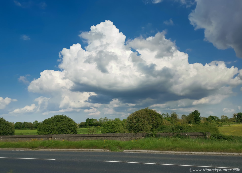 |
As we sat and waited for Roisin to meet me here with Rhua so we could go to the vet's together we began to notice a change. The Nly breeze was now pushing clouds to the S and the convection began to get more robust, difficult to do justice here with the phone shots but this one was beginning to grow in height however we just assumed another cap death was coming so passed little remarks.
 |
It kept getting taller and the base was darker and the top looked like it was glaciating, even looked to be hints of light precip falling from the base. It was 17.50 and Roisin arrived so I needed to leave, I pointed at this cell and said to Nigel ''this is one to watch''. Roisin and I drove to the vets outside Magherafelt and by pure coincidence the country roads took us directly under that base, once at the vets we where directly under the updraught and it felt like something was about to happen. Five minutes later while we where with the vet the heavens opened, torrential rain fell, then hail stones, estimated at 10mm in size, bonunced off the grass outside the window, everyone was commenting on the hail including the staff, then thunder!, that convection we had been watching from the Moyola had been a growing thunderstorm, the cap had finally broke.
 |
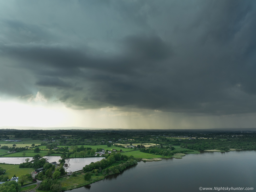
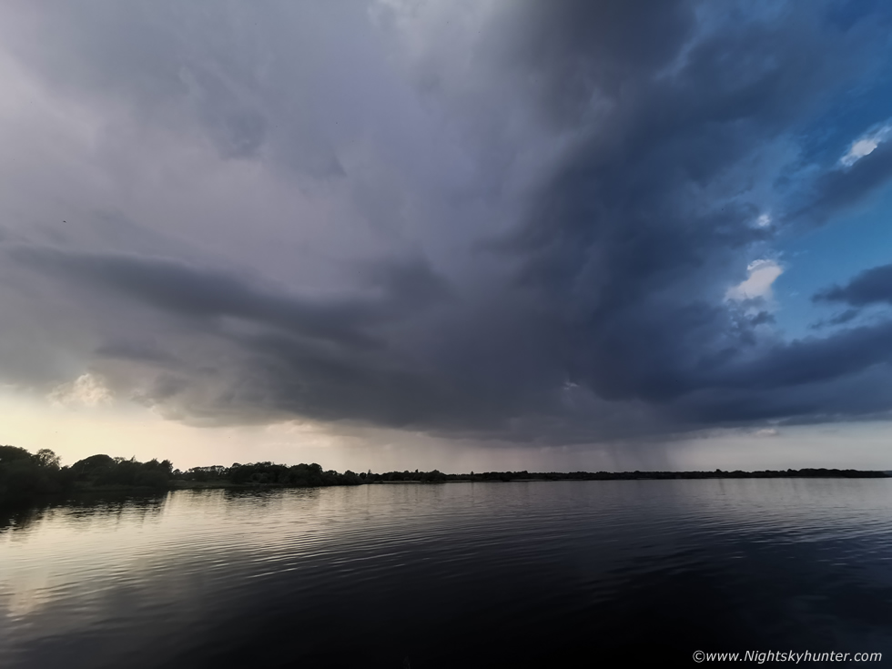
More thunder rumbled over the vets, Rhua got sorted, the roads were all flooded and Roisin drove me back to the van at the Moyola. This was the back end of the same storm, not much to look at but hail was falling under the base. Roisin was going to take Rhua home so I could go chasing for the rest of the evening, I knew Nigel and Colleen Webb would be targeting the expected lough cells so on an instinct I made my way to Ballyronan to see if they were there. As I approached Ballyronan three things were apparent. First there was another cell over the N end of the lough, another more impressive cluster of what looked like storms to me where over the S of the lough and inland, and thirdly the trees were covered in spectacular displays of flies with tall dark swarms and fly 'nadoes' dancing over the tree tops, it was really stunning. On a normal day I would be shooting those but the storms were a priority.
 |
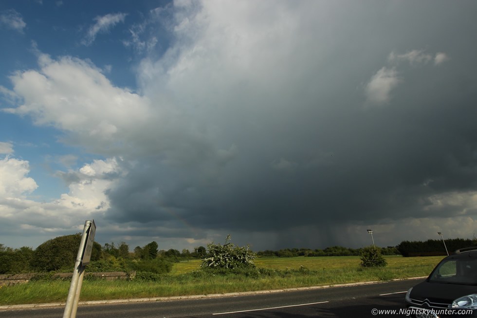
I spotted Nigel and Colleen's cars then grabbed my gear and ran out to the pier where I could see them standing cameras already in action. Nigel had the lightning trigger set up, it was warm, the flies buzzed around us and we had a close range storm late in the evening. I got the drone up for a better view, thunder rumbled across the countryside, it was a high dynamic range scene with bright light coming through from underneath the base which also back-lit the storm. You can see from the base on the left that this was a narrow updraught, but it was producing and that's all that mattered.
 |
Storm creeping slowly towards us. These are the moments we live for, up close and personal with a storm. OK it wasn't a looker but it sure was rumbling away well and in the silent evening those rumbles were pure bliss, we had earned them. No c-g bolts were visible at all, we didn't even seen intra-cloud bolts, all the activity must have been high up inside the updraught, the thunder from those heights is always very distinctive, like muffled thunder and you can tell its descending from height.
 |
Behind us to the S impressive convection was unfolding, storms all over Dungannon and Armagh and another cluster over Omagh. John Fagan rang to confirm he had a good storm over his area rumbling away and it was photogenic. Our own storm was now spent but we got at least half an hour of thunder from it so we got something. I was just annoyed I didn't get any good structure so I was still on the hunt, we contemplated chasing those storms S but knew they would be well gone by the time we got there. We all headed home content enough, technically this was my second storm of the day.
 |
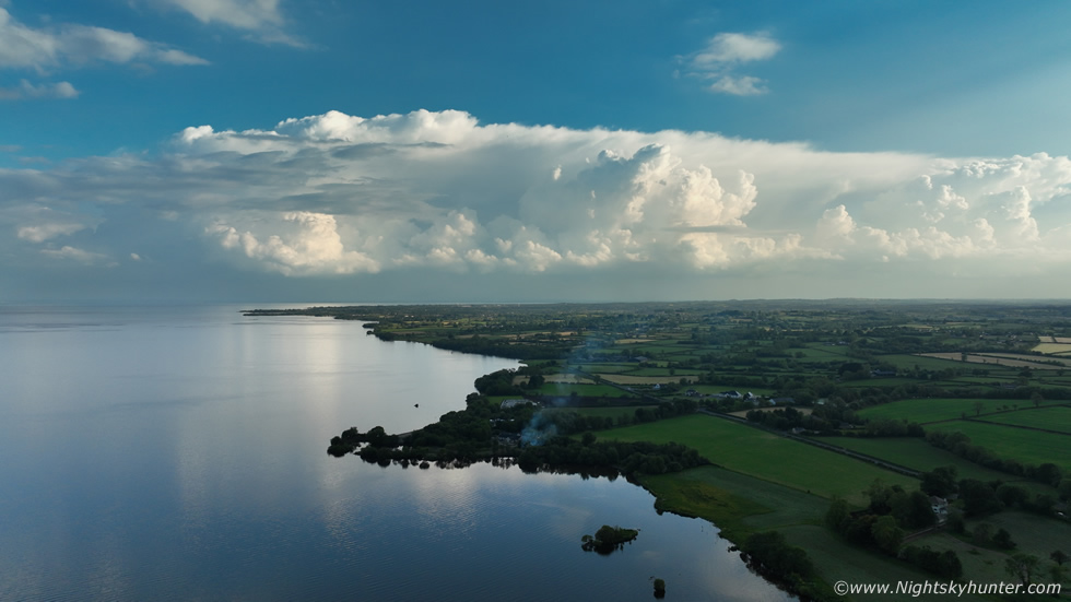
I was back in Cookstown bringing in the camera gear then sat down to a quick salad, it must have been after 20.00, Roisin wanted to go out for a walk so we would be leaving soon. I opened the back door, looked outside and was shocked to see dramatic looking towers close by to the E. Actually they formed a line extending from SE near the lough, passed here and on to Dungannon. It was really difficult to do justice to these as they looked so much better in real life than on the drone, I called Roisin out to look and she was impressed. It was the textures in late evening light, the vivid whites, shades, the yellowing along the bases, the cauliflower knuckles on the convection all in high contrast, I love scenes like this, maybe I was getting the photogenic skies I wanted now.
 |
The towers got taller and began to spread out downwind to form the early stages of a weak anvil, these were actually trying. Half an hour later I lost sight of them to the S when I got another call from John Fagan, he had another thunderstorm over Dungannon, it had to have been these very updraughts which did it, so those towers were a developing storm, that was cool. At this stage I really thought the day was over, Roisin was nearly ready to go, it was well after 21.00, before leaving I noticed one more tower to the SE in the warm evening light, it likely was too late now for it to do anything, so Roisin and I hit the road.
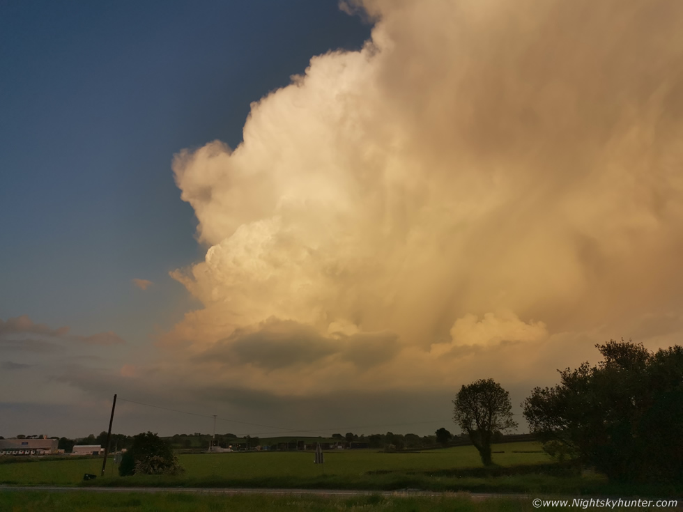 |
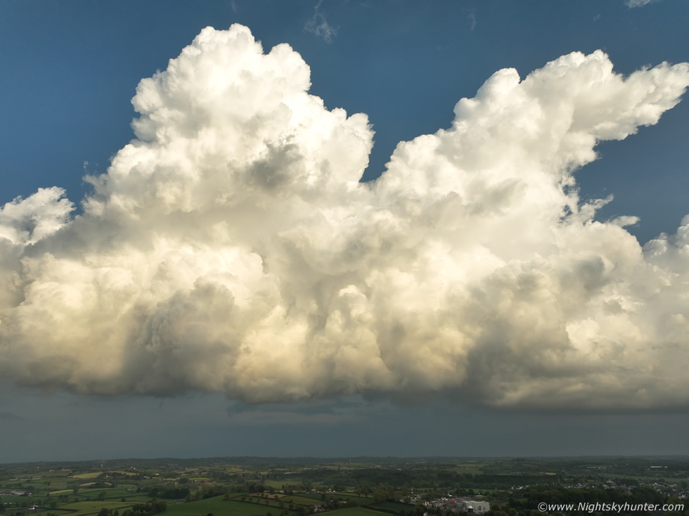
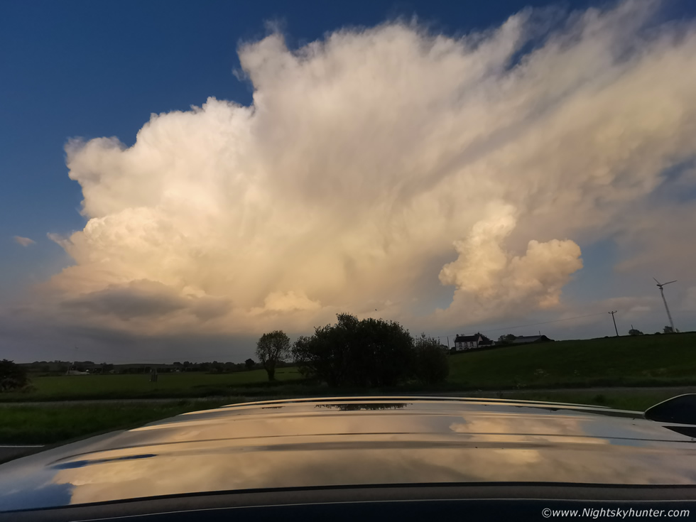
We were driving along the carriageway between Cookstown and Moneymore when we enter a clearing and seen a big cell which seemingly had appeared from nowhere a few miles away to the SE, we pulled over onto the shoulder and got out for images. I was mostly using my mobile phone camera for these unless otherwise stated. For me this was the treat of the day, entire cell lit into a surreal orange-yellow-gold glow, I looked behind me and the sun was only a few degrees from setting in a clear sky. The main updraught was gorgeous with crisp knuckles with cauliflower tops expanding upwards to a big height, this was the best updraught I had seen all day. It was already producing precip and the anvil was forming and beginning to propagate downwind. Then thunder, it was now a storm!
 |
This good mobile phone has three cameras, the first was the standard wide field of view, however the images are not high res, to get that option you have to go into Pro Mode and select High Res which is a bigger file which is what I did here. Capturing the storm reflecting on the roof of the car, this was the superwide angle mode which is so wide that the FOV is just ever so slightly curved at the edges. Also the white balance is too cool in this mode (auto) compared to the normal camera in auto which nailed the vivid colours perfectly. These gripes aside it was a beautiful cell and I was getting that buzz and in the zone, I just kept shooting images as it evolved. More thunder rumbled, what a fantastic surprise, I really had thought this day was done, but here was storm number three and it was a looker, and doer.
 |
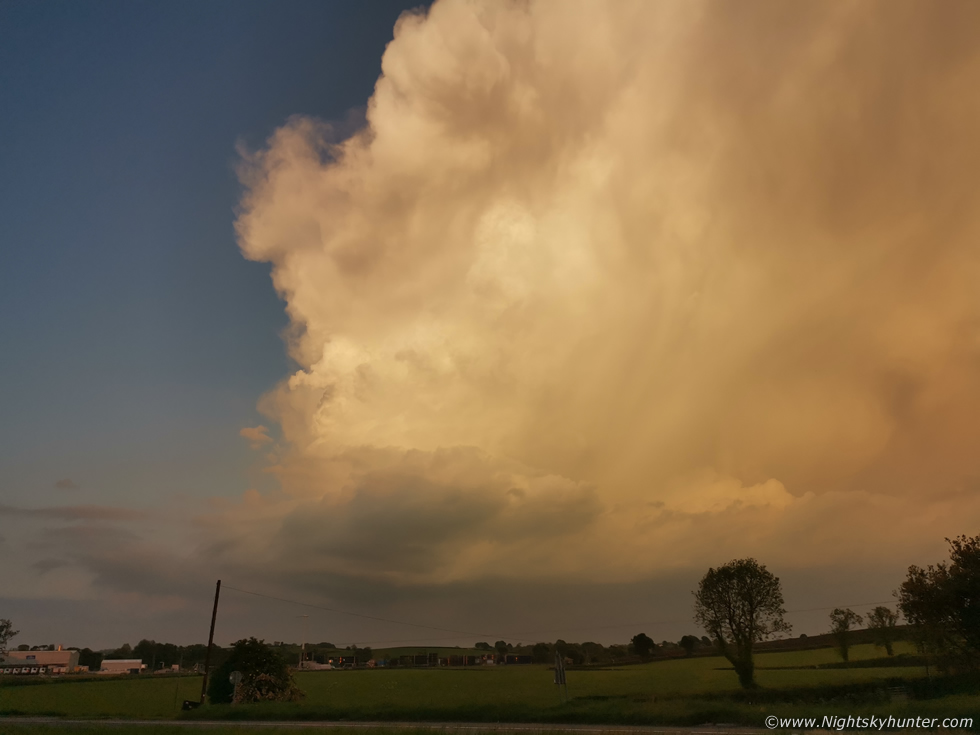
Pro Mode with super wide angle camera showing roof reflections. The sun was literally minutes from setting. You can tell that the forward end of the anvil was weak like all the storms today, however the single updraughts and rear sector of the evening anvils were much better. This storm was ingesting the last reserve of CAPE available in the now fully uncapped air.
 |
No time to get the drone up for this one so I just concentrated on hand held ground shots. Storm moving L to R, I didn't hear any more rumbles but there could well have been however the passing traffic was quite loud.
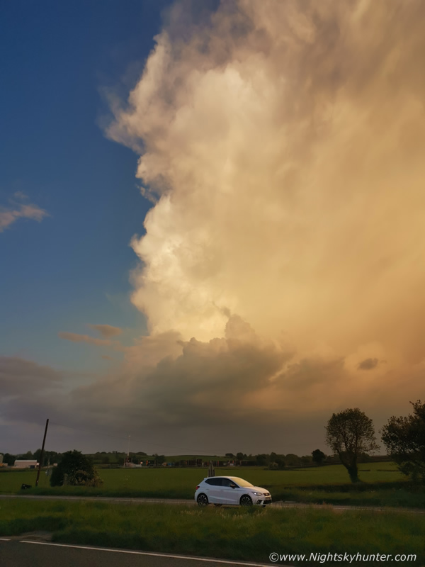 |
I was leaning across the roof shooting, a few cars beeped their horns with passengers yelling out the window, not in anger but in admiration as if they knew what I was doing and approved, they were obviously storm fans too.
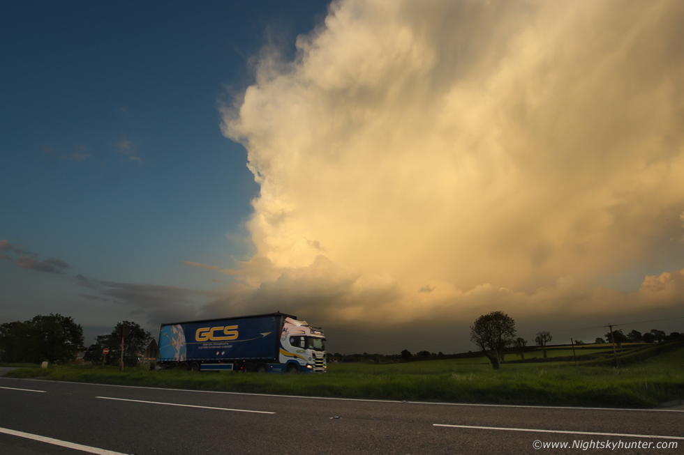 |
I finally took out the DSLR with 10mm lens for a few images before the sun vanished. The storm was now weakening and it's anvil was spreading out across the sky. That was ten minutes of fun I never anticipated today, you got to love set-ups that have CAPE present rite through to late evening, there's always a surprise waiting to be captured near the end of the day. So despite not seeing any structure today this sunset storm balanced the scales and provided me with something that was nice and photogenic after all. There's only one truth about storm chasing and that is to never ever give up. Roisin and I went for our evening walk, the sun was gone and the storm anvil hung over the tree tops with mammatus in beautiful pink colours against the twilight sky. I will take all this in the meantime until the more spectacular storms make an appearance, when they do I will be ready.
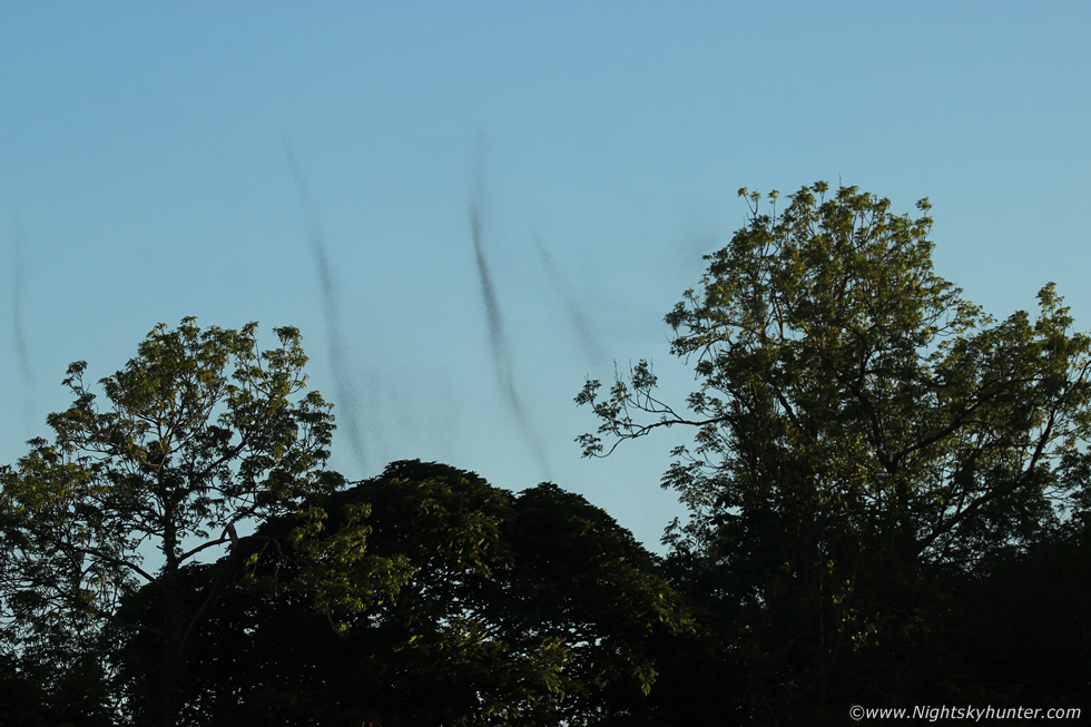 |
The next day I went on the hunt for the Lough Neagh flies, I spent a couple of hours 'fly chasing' along the back roads near Ballyronan. There was a stiff breeze which kept them at bay but before sunset it eased just enough for them to form into their tornado swarms. They really are amazing to watch through a telephoto lens. In the days which followed I ended up getting very sick and still am as I write this near the end of May so if parts of this report don't make sense than that is why. I hope to be back on the road soon. Thanks very much for reading.
Martin McKenna